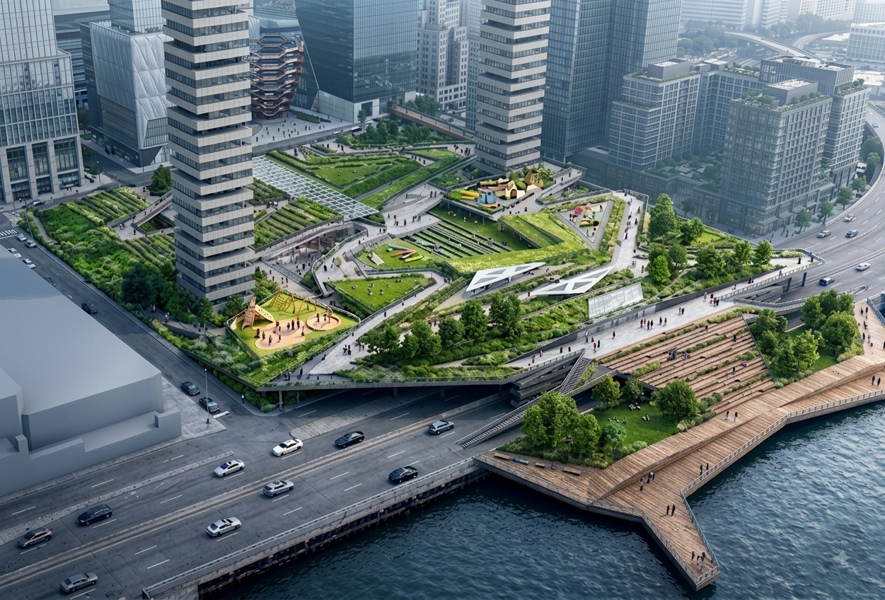
OVERLOOK NEW YORK WATERFRONT
An elevated landscape infrastructure stitching the Manhattan waterfront across rail yards and the West Side Highway - a continuous public ground negotiating city, river, and movement.
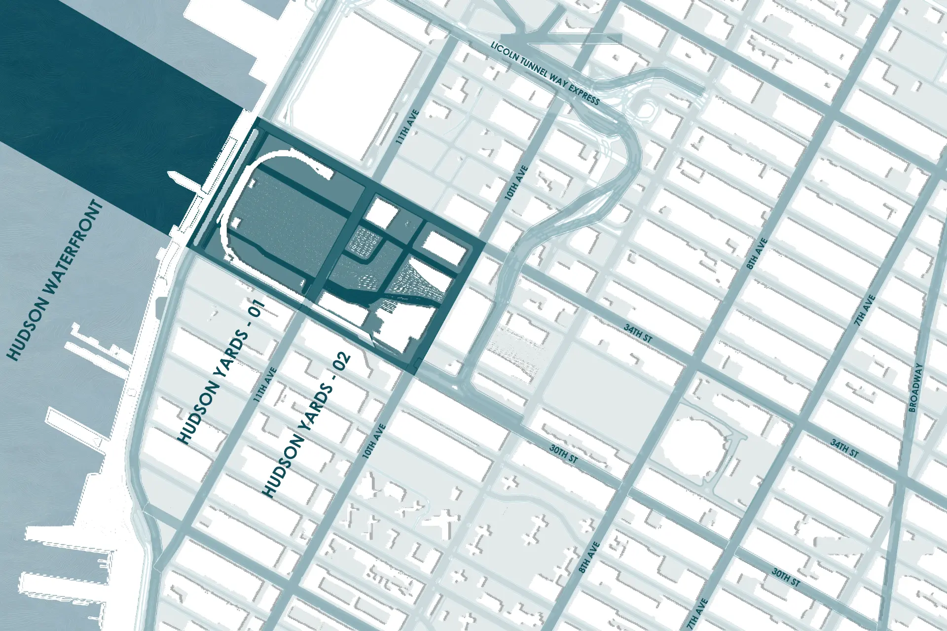
BETWEEN THE HUDSON AND THE GRID.
The site sits between the Hudson waterfront and the Manhattan grid, with the Hudson Yards rail yards cutting a hard void through the middle of the block structure.
Mapping the avenues, the tunnel approach, and the water edge sets the terms for a project that must cross rather than occupy.
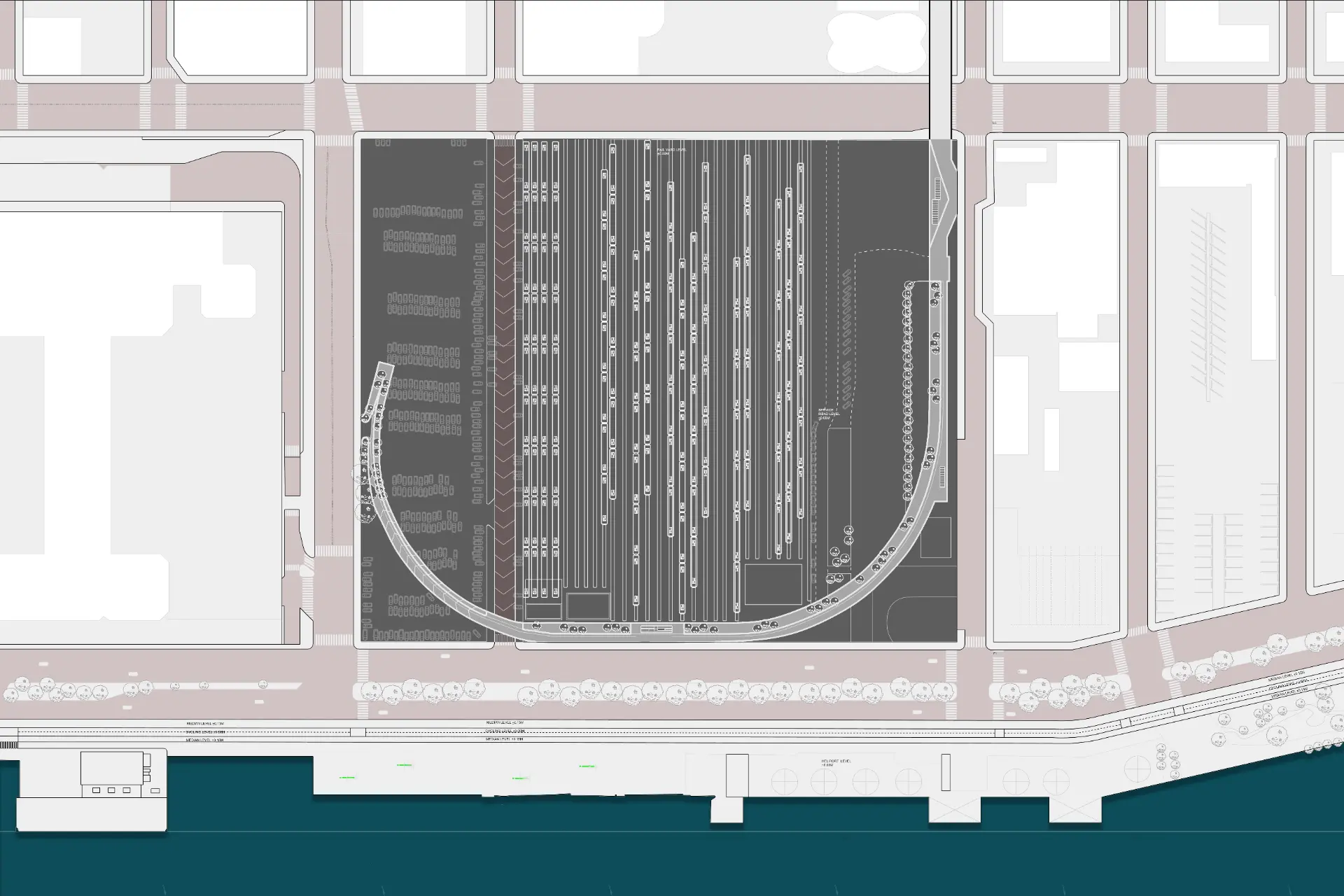
THE WORKING GROUND BELOW.
The existing yard is read as an operating machine - storage tracks, service roads, and the loop that turns trains at the western edge.
By treating the West Side Highway and its service roads as an infrastructural threshold rather than a barrier, the scheme introduces a continuous pedestrian thread from Hudson Yards 02 to the Hudson River waterfront. Through sectional grade separation, vehicular transit and parking operate undisturbed at grade, while an elevated public concourse restores human connectivity to the river's edge.
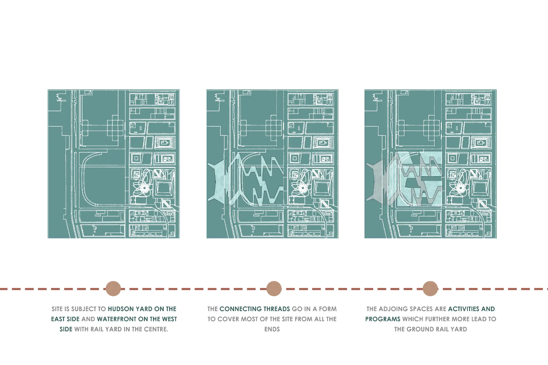
THREADS ACROSS THE VOID.
Three moves: register the site between yard and water, run connecting threads from every edge, then thicken the spaces they enclose into program.
The zigzag figure is a consequence of stitching, not a formal gesture.
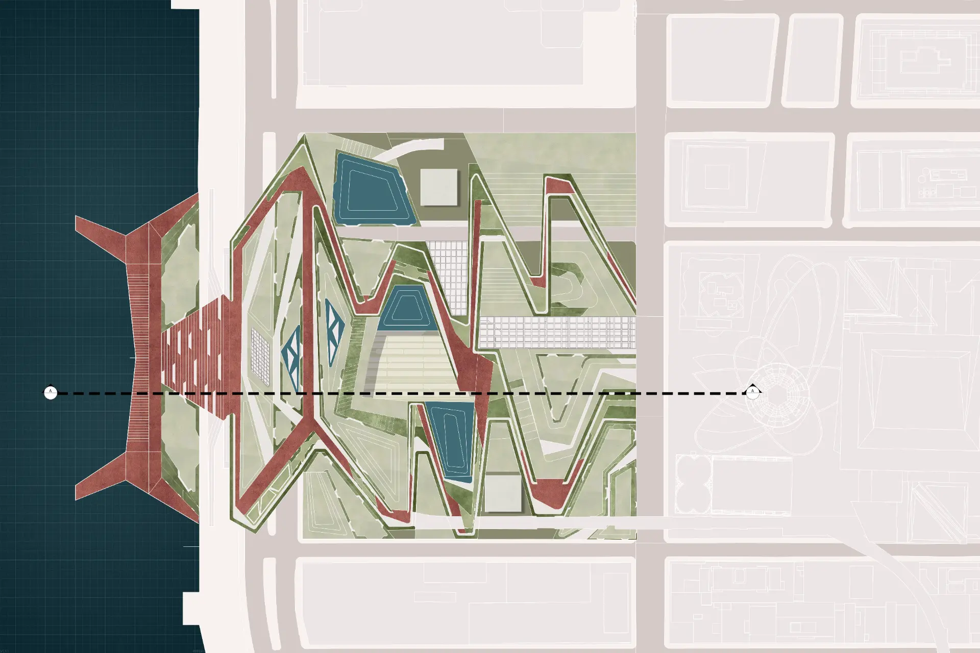
A NEW PUBLIC GROUND.
The plan resolves into terraced lawns, EPDM kids play area, and a folded circulation spine that reaches out over the Hudson as a deck.
Soft ground and hard ramp are held in a single continuous surface.
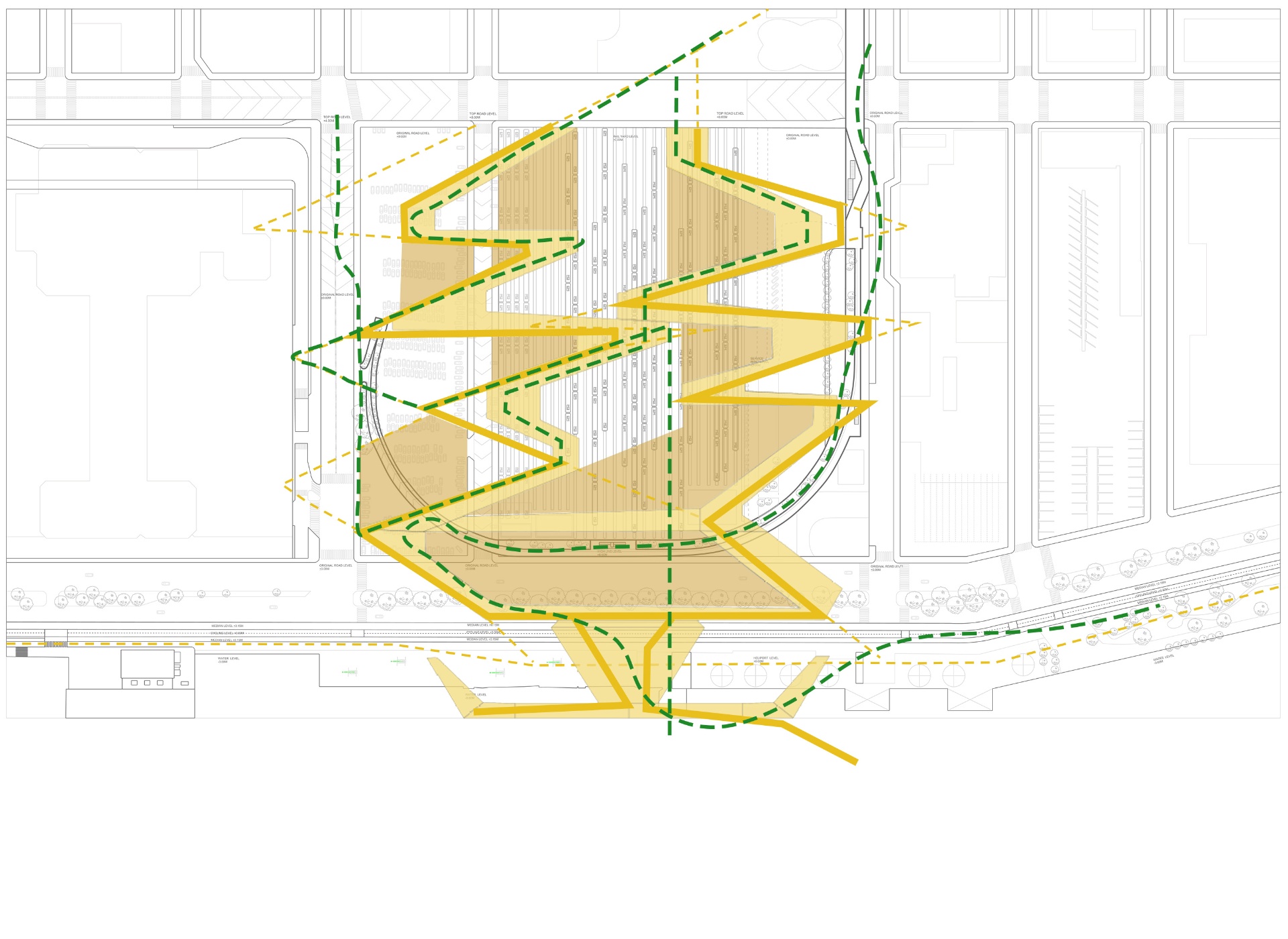
MOVEMENT AS STRUCTURE.
Circulation is drawn first: the diagram traces how pedestrians arrive from the avenues, cross the yards, and descend to the river.
Every programmatic pocket is a by-product of a route.
STACKING CITY, YARD, AND WATER.
The section registers the full depth of the site - waterfront deck, highway roof access, rail yard level landscape, and the towers beyond.
Public ground is inserted as a layer, not as a replacement.
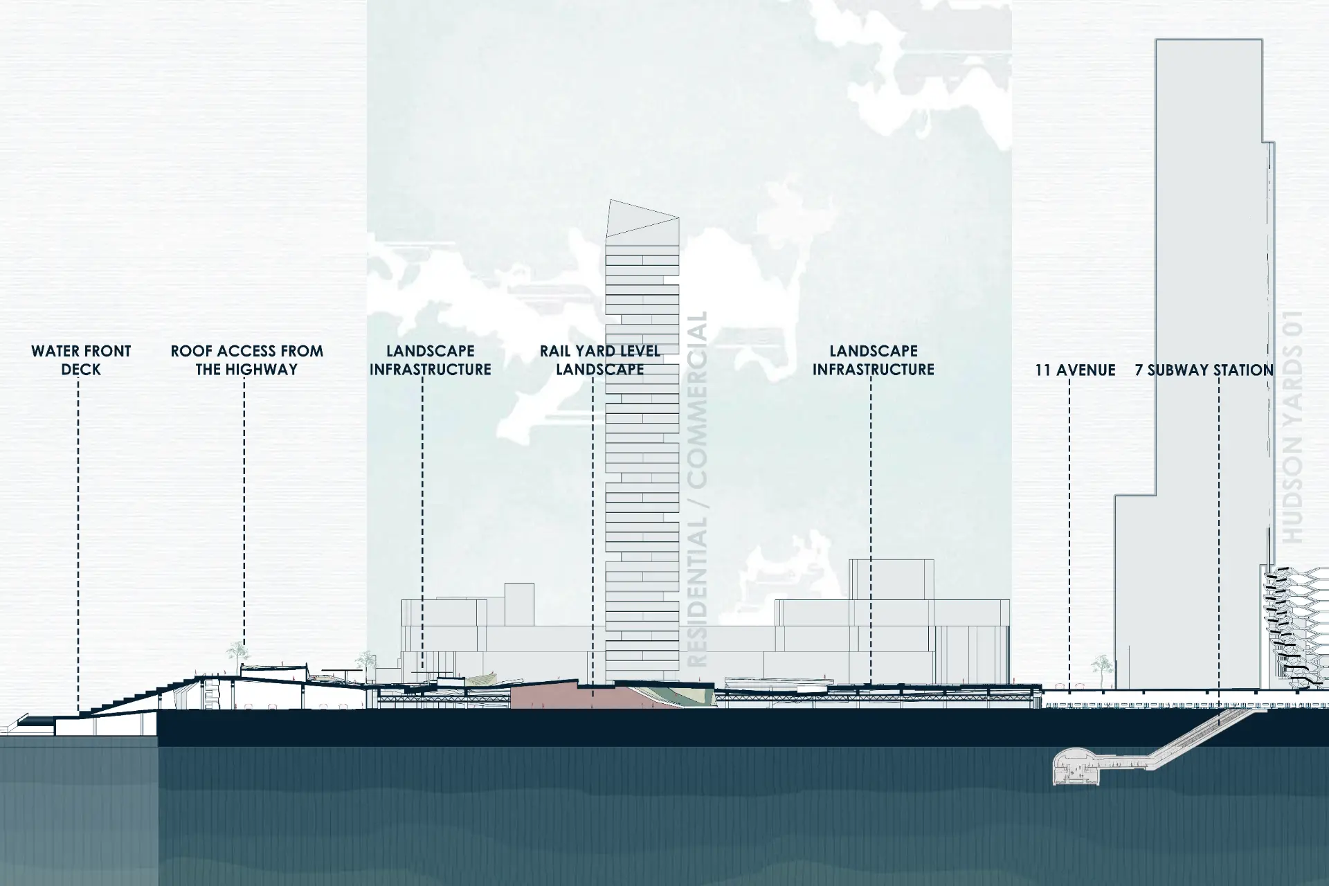
READING THE SECTION AT CITY SCALE.
Annotated across its full length, the section shows how landscape infrastructure negotiates between the 7 subway station, 11 Avenue, and the river.
The datum stays continuous while everything beneath it changes.
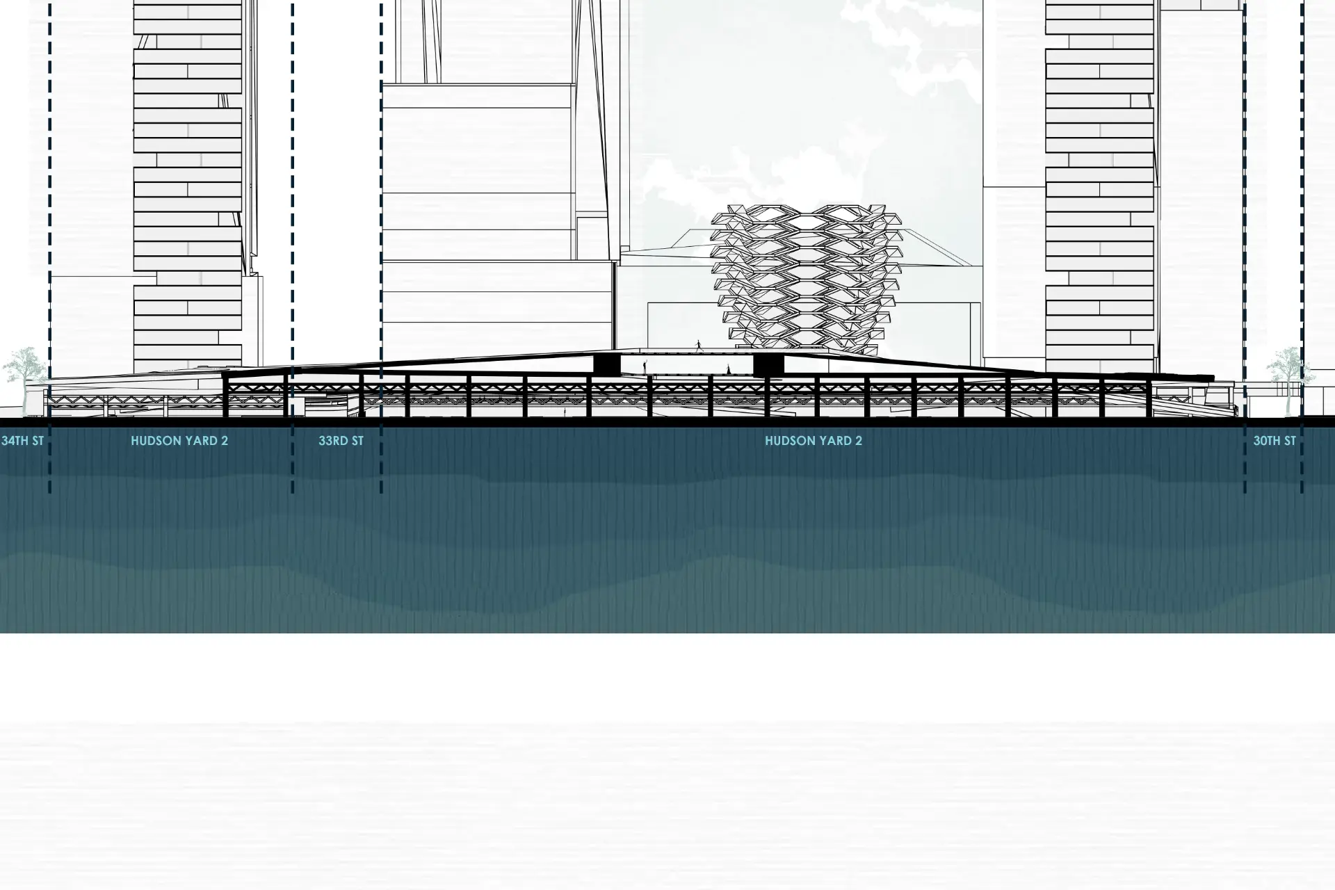
A THIN ROOF OVER THE TRACKS.
Across 30th to 34th Street the new deck reads as a shallow truss field carrying a lifted public plane above the working yard.
The lattice pavilion marks the crossing at the centre of the span.
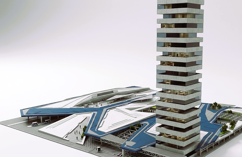
TERRACES, CANALS, AND PLANTING.
At closer grain the ground becomes the circluation, planted terraces, and paved thresholds calibrated to slope and drainage.
The landscape does the work of both surface and infrastructure.
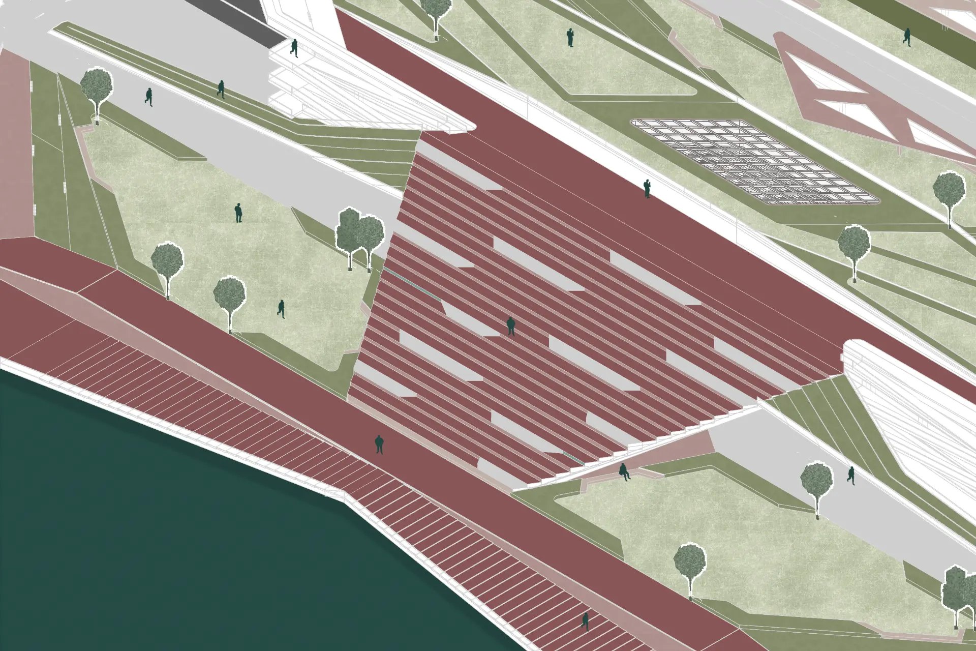
STEPS DOWN TO THE RIVER.
The stepped deck folds from the elevated ground toward the waterfront, giving the edge a public seat facing the Hudson.
Red circulation planes cut through green terraces as the connective tissue of the scheme.
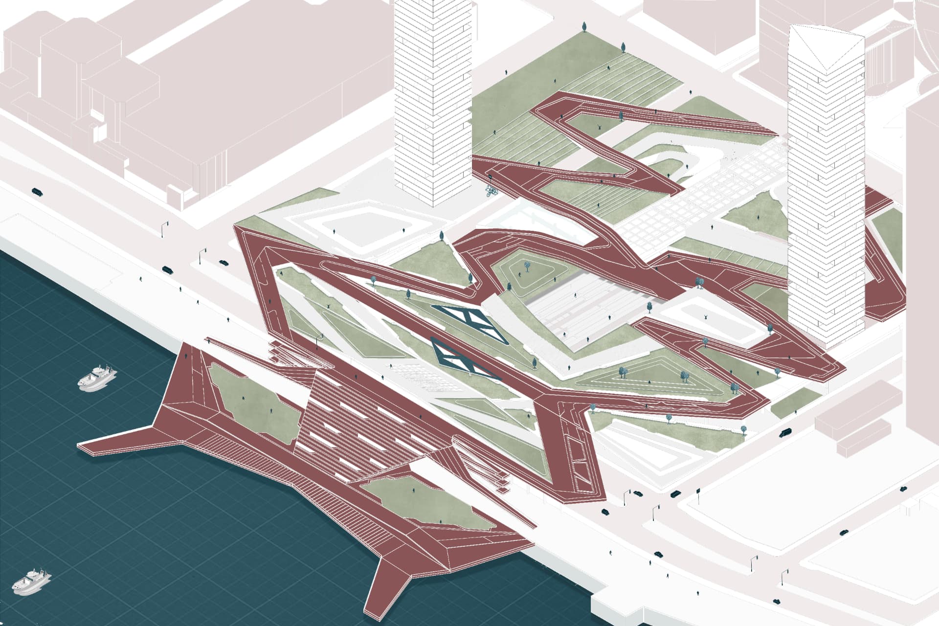
THE WHOLE FIGURE.
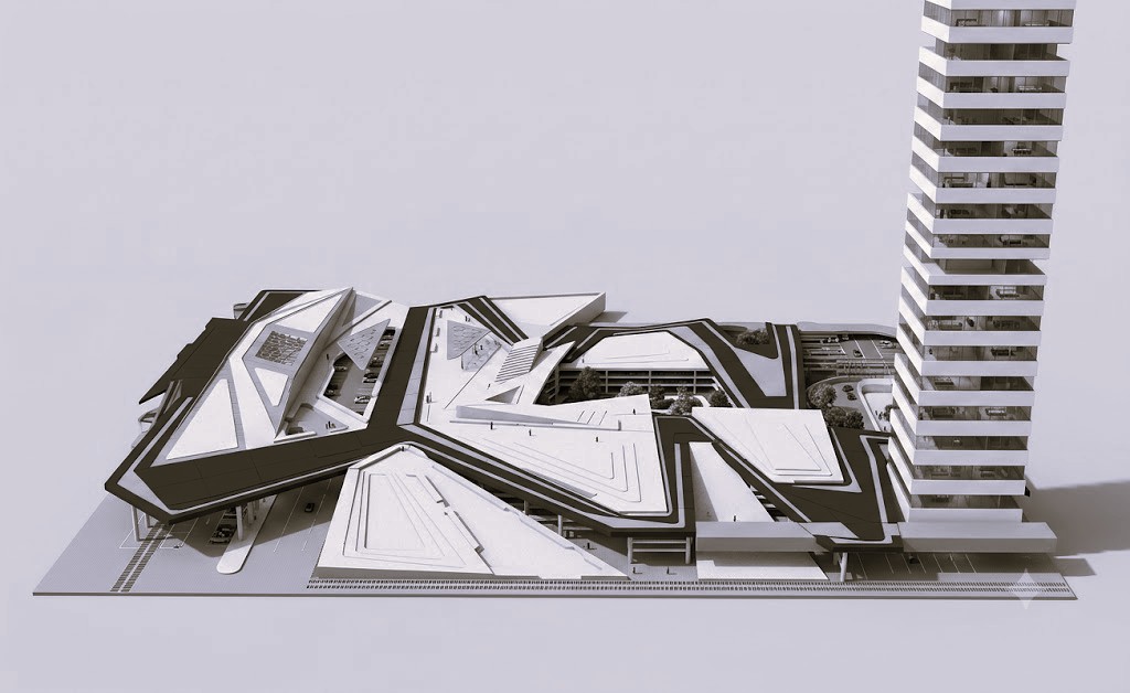
Seen from above, the project registers as a single zigzag figure locked between the towers and the water.
Its arms reach into the grid at one end and out into the river at the other.
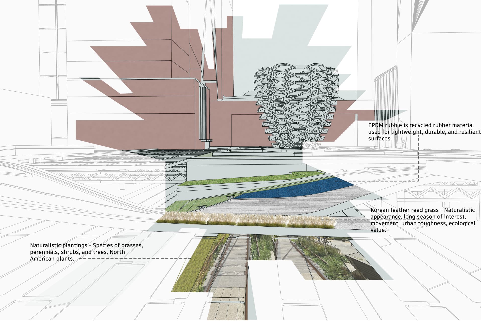
A LIGHTWEIGHT, RESILIENT SURFACE.
EPDM rubble, naturalistic North American plantings, and Korean feather reed grass form a palette chosen for weight, durability, and ecological value.
The materials are selected to sit lightly on a structure spanning live rail.
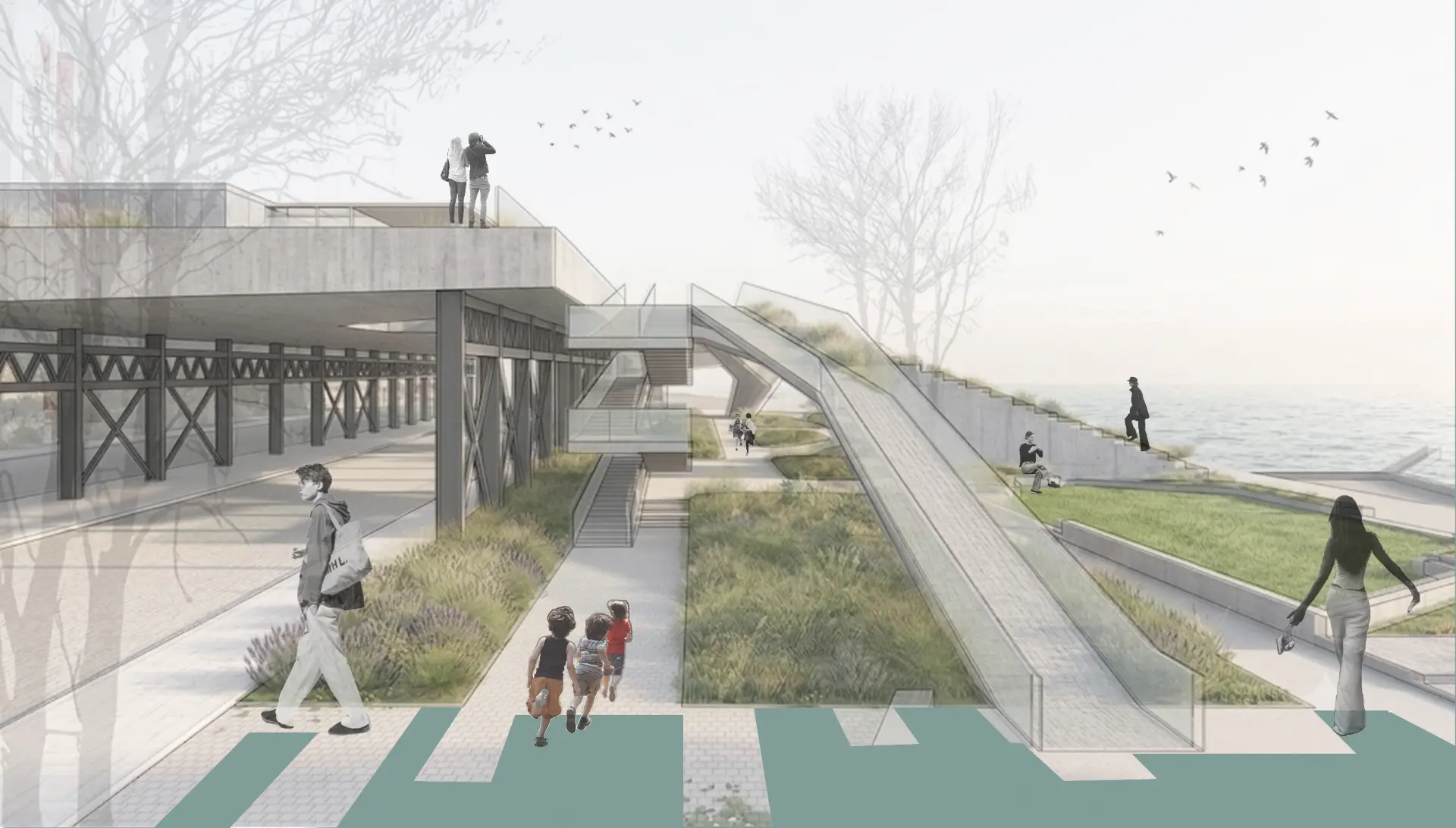
ARRIVING AT THE EDGE.
At the water, ramps, stairs, and planted slopes bring the elevated ground back down to the promenade.
The infrastructure becomes ordinary again at the moment it meets the public where the infrastructure doesn't disturbs the vehicular transportation.
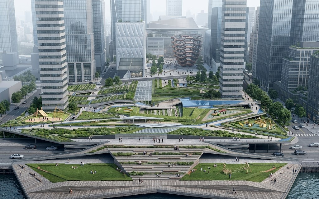
THE PROJECT AS A LIVING LANDSCAPE.
The full aerial view resolves the project as a continuous public ground - terraced lawns, water features, and circulation paths woven between the towers and the Hudson.
The render reads the scheme not as infrastructure alone, but as a new piece of city held between the grid and the river.